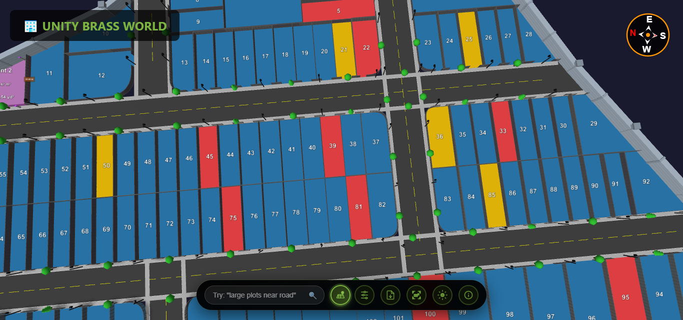
3D Site Plan for Builders: How Interactive Layouts Help Sell Plots Faster
Learn how 3D site plans help builders present plots professionally, build buyer trust, and close deals faster.
Expert guides, tips, and insights about 3D plot visualization, land mapping, and real estate technology

Learn how 3D site plans help builders present plots professionally, build buyer trust, and close deals faster.

Complete guide to all tools developers need — CAD, CRM, RERA, marketing, 3D visualization, and project management.

Everything you need to know about plot layout software — types, features, free vs paid, and how to choose.

Compare GIS, CAD, and visualization tools for accurate plot mapping. Indian market focus.

Complete buyer's guide to RERA approval — verification steps, documents, red flags, and state-wise portals.

Overview of all marketing tools for plot selling — portals, WhatsApp, 3D views, Google Ads, and more.

Deep dive into 3D plot views — technology, buyer experience, sales impact, and comparison with alternatives.

Practical guide to creating plot layouts online using Google Maps, SmartDraw, AutoCAD Web, and QGIS.

Compare the best plot layout software, 3D site plan tools, and plot mapping software for builders, developers, and brokers.

Convert your PDF plot map to 3D in minutes. Free online tool for real estate developers and brokers. No software needed.

Learn how to sell plots for sale online using 3D visualization. Boost buyer trust, reduce site visits, and close deals faster.

Don't buy land without checking these 5 critical layout factors. Learn how 3D visualization helps you verify every detail.
PDF maps are becoming outdated. Discover why leading builders are adopting 3D visualization to sell plots faster.

Understanding land plot maps is essential for property buyers. Learn how to interpret boundaries, measurements, and symbols on traditional paper maps.

Discover how 3D visualization technology is revolutionizing the real estate industry and helping developers close deals faster.
 Comparison
A detailed comparison between traditional 2D paper maps and modern 3D digital visualization. See why more professionals are switching.

Learn how tracking visitor interest on your 3D plot viewer helps identify high-demand plots and optimize pricing strategies for maximum returns.

Transform topographic survey data into interactive 3D plot visualization. Learn how topographic surveys create accurate 3D land maps for real estate.
Comparison
Discover why interactive 3D plot view is superior to traditional PDF maps. Compare features, benefits, and see how 3D visualization transforms property viewing.