Best Cities to Invest in Plots in India 2026: Data-Backed Top 10 List
Top 10 Indian cities for plot investment ranked — Hyderabad, Bengaluru, Pune, Chennai, Jaipur and more.
Turn your existing 2D plot PDF into an interactive 3D viewer your whole team shares on one WhatsApp link — with every buyer enquiry captured automatically into a built-in CRM.
Free consultation · No signup, no obligation


Drop your plot PDF or image — our AI reads the layout in seconds and we send you an interactive 3D demo link you can share with buyers on WhatsApp.
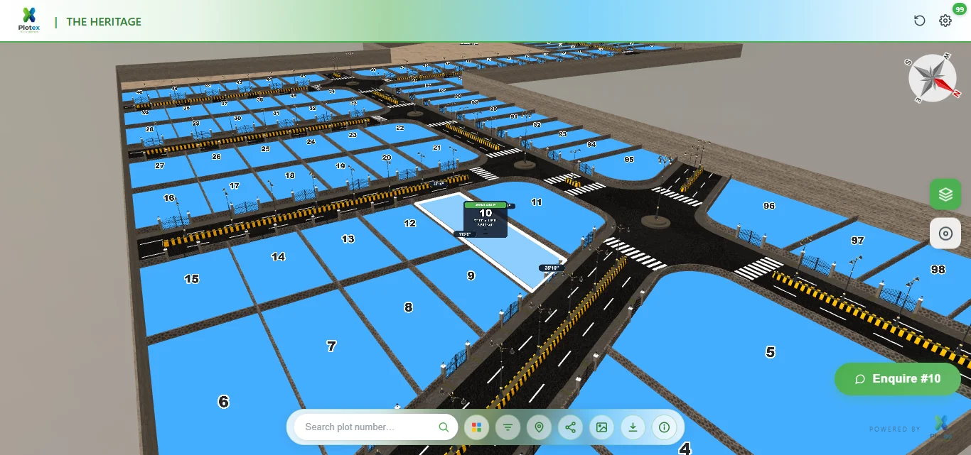
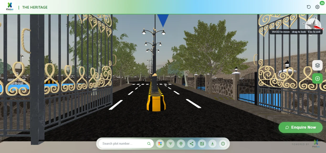
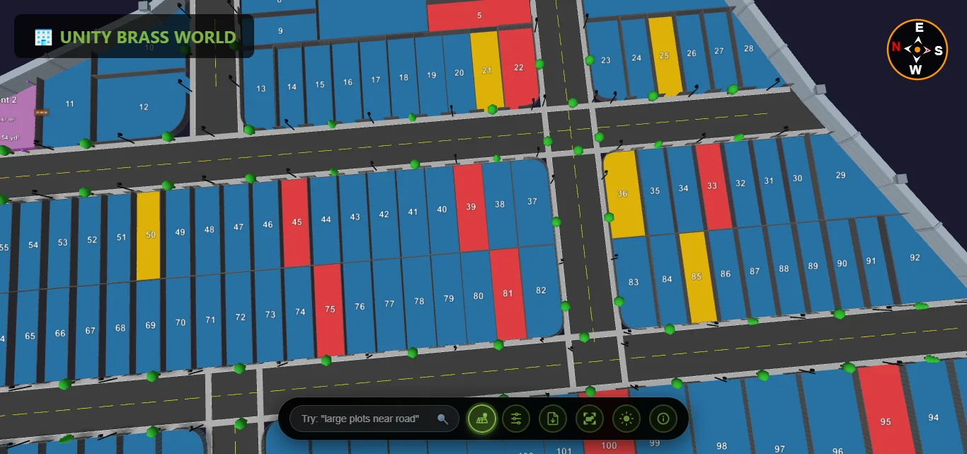
This is a live plot layout — pan, zoom, and tap any plot to check availability, exactly what your buyers get on their phone. No app, no download, just a link.
Prefer a new tab? Open the live demo ↗
Everything you need to visualize, analyze, and share land plot information
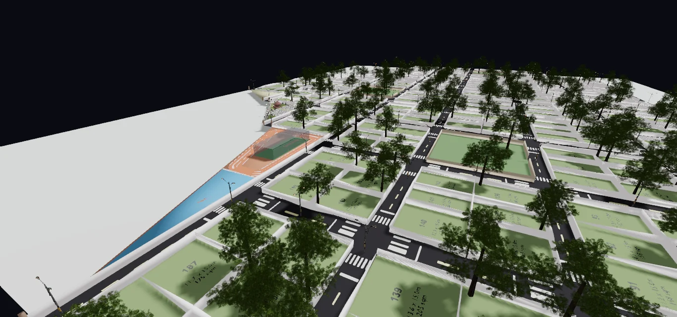
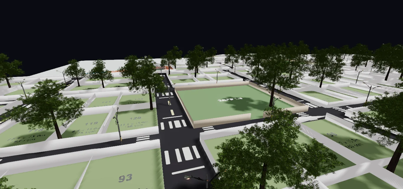
Interactive 3D environment with realistic roads, trees & boundaries
Manage leads, track user location, viewer analytics & inquiry data
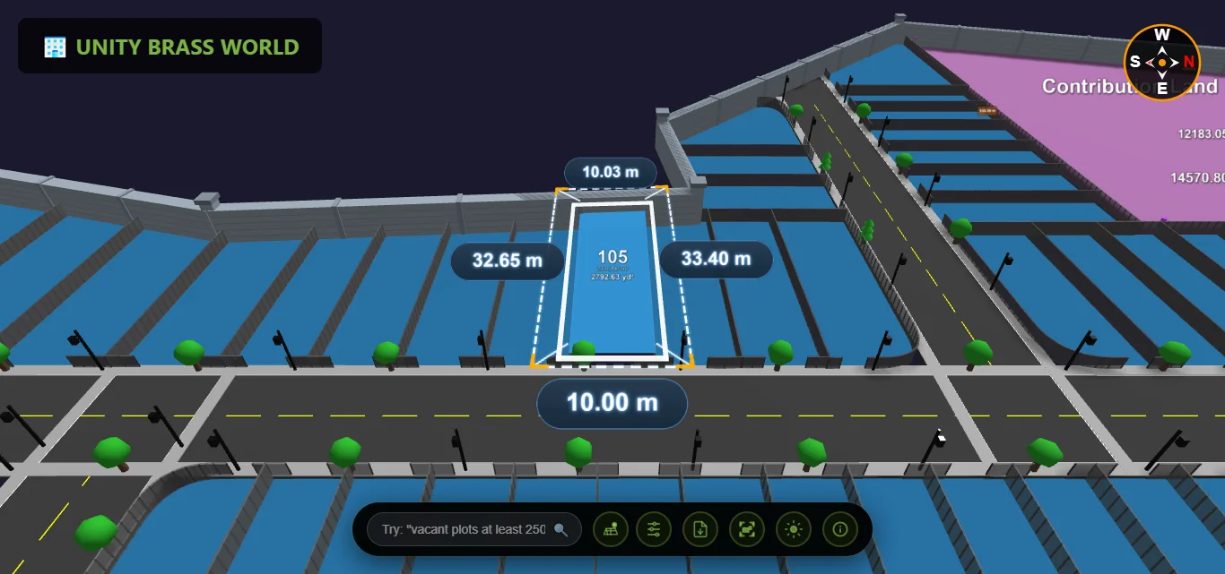
Exact dimensions & area calculations with professional accuracy

Instant identification of available, sold & reserved plots
Filter by area, price, road proximity & booking status
Share via link, QR code or embedded viewer instantly
Share interactive 3D plots on any device — then capture, track, and manage every lead in one built-in CRM. No app, no spreadsheets, no missed buyers.
Every buyer who opens your 3D plot link is captured automatically — then tag, assign, and track follow-up status in one clean dashboard. No manual entry, no spreadsheets.
See exactly which plots get the most views and interest, so you know what's hot and which inventory to push.
Track each buyer's journey — which plots they viewed, how long they stayed, and what caught their interest.
Get an instant alert the moment a buyer shows interest in a plot — reach out while they're still hot.
Connect leads straight to WhatsApp and follow up where Indian buyers actually respond — right inside the flow.
Assign leads to brokers, track their performance, and manage your entire sales team from one place.
Share a link. That's it. Your clients view plots instantly with zero downloads or app store visits.
Chrome, Safari, Firefox, Edge — full 3D performance on every modern browser, desktop or mobile.
Once loaded, the 3D viewer works without internet. Perfect for on-site plot visits in low-signal areas.
One interactive 3D layout, three wins — builders sell faster, sales teams work smarter, and buyers decide with confidence.
Everything you need to know about Plotex
Plotex turns your existing 2D plot map (PDF or image) into an interactive 3D plot viewer. We rebuild your layout as a 3D site plan where buyers can pan, zoom, see which plots are still available, and tap a plot to enquire — all from one link you share on WhatsApp. Every enquiry is captured into a built-in CRM so your team can follow up fast.
Just drop your plot PDF or image into the upload box on this page. Our AI reads the layout in seconds and we prepare an interactive 3D demo of your first plot. No CAD skills, no software to install, and nothing for you to draw — we do the conversion for you.
We convert your first plot layout into an interactive 3D viewer so you can judge the quality on your own project before committing. Pricing is simple and per-project, with volume rates for agencies and brokers. See the pricing page for details.
Yes — the consultation is completely free, with no signup and no obligation. We will discuss your plotting project, show you a live 3D demo, and explain exactly how your own layout would look and work in 3D and how buyers would use it. The 3D viewer itself is then priced simply per project. Drop your plot PDF above or contact us to book your free consultation.
Yes. The viewer runs in any mobile browser with no app or download. You share a single link — ideal for WhatsApp — and your buyer opens the full interactive 3D layout on their phone, from anywhere in the world.
Every buyer who opens your 3D plot link and enquires is captured automatically into a built-in CRM. You can see which plots get the most interest, assign leads to brokers, and follow up the hottest plots first — no spreadsheets and no missed buyers.
We rebuild the 3D viewer faithfully from your sanctioned layout, keeping plot numbers, sizes, and road positions true to your plan so what buyers see matches what you are selling. Share your final approved PDF and we will match it.
That is where a 3D viewer helps most. Remote and NRI buyers can explore the entire layout, compare plots, and shortlist online before they travel — so a site visit becomes a booking instead of a first impression.
Plotex is built for Indian real estate developers, plotting-scheme promoters, and brokers selling residential or farm plots — anyone who wants buyers to understand a layout instantly and book faster, instead of squinting at a paper map or PDF.
Tips, guides, and news about 3D plot visualization
Explore our 3D plot viewer software, plot layout software, and how to sell plots online.
Popular guides: plot vs flat investment · NRI plot investment · red flags before buying a plot.

Top 10 Indian cities for plot investment ranked — Hyderabad, Bengaluru, Pune, Chennai, Jaipur and more.

The complete pre-purchase verification checklist for plot buyers — RERA, EC, 7/12, and 3D view tips.
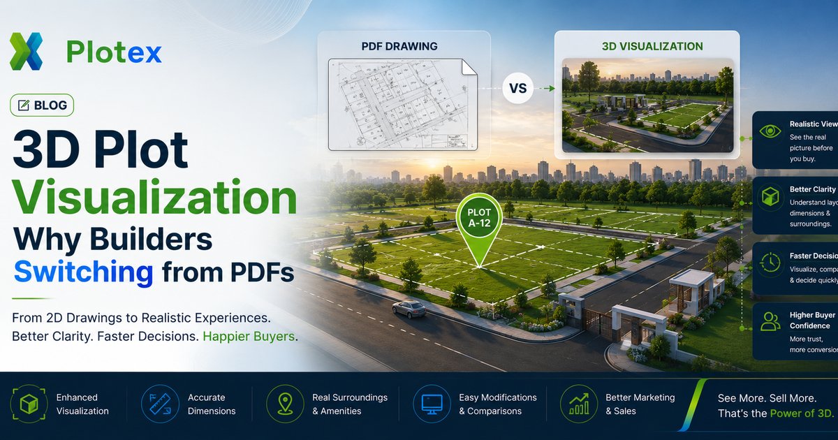
Conversion data, NRI buyer trust, WhatsApp shareability — why builders are dropping PDFs.
Book a Free consultation and see your plots in 3D. Join hundreds of developers who have modernized their plot viewing.